Sunday, May 22, 2011

Alpine Visit May 22

Alpine, WA May 22, 2011.

On Sunday we wanted to see if there were any remains of the water tank shown on the 1927 map. A.F.E. 11554 2-28-1920, a 50,000 gallon tank 60 feet from center of the track.


We scored huge.


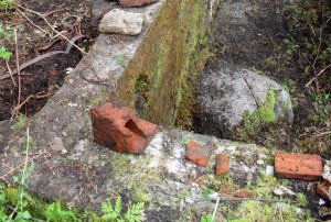
On the right you can see the supply main from the creek, a 6" wire wound wood pipe.


We spent some time digging around the saw mill foundation.


This light bulb was under a piece of metal.


A Patterson's Tuxedo Tobacco tin was a few feet away from the light bulb. It was completely covered with tar that probably inhibited corrosion.


Donna found this concrete thing east of the saw mill. It measures 26" x 84" and has six anchor bolts on top.


It is in the vicinity of the shingle mill, a small building, 25' x 28'. The south side was 122' from the tracks. Our concrete thing was 125' from the tracks.


Looking west, the saw mill was about 200' in the distance.


The concrete block is down the bank, about 10 feet below the tip of the arrow. The red line is the approximate location of the Alpine Lumber Company railroad spur. There was a platform extending about 40 feet from the railroad spur, over the bank. Photo was taken near the tracks next to the signal.


Wednesday, May 18, 2011

Alpine Map

Alpine, WA May 18, 2011.

Bob Kelly at the Skykomish Historical Society has found another Alpine map.


Dated February 1926, there is an interesting note written on the saw mill:
NOT IN OPERATION JULY 1930 TO BE DISMANTLED AND TORN DOWN

Tuesday, May 17, 2011

Section 27

Alpine, WA May 17, 2011.

I was scouting around Section 27 today and got a picture of the Alpine vicinity from the Tye River.


You can see my position in relation to Alpine on this map.


This is a very interesting area. The Stevens Pass Highway, from 1924 until maybe 1940, was on the far side of the river bank. You can see a culvert pipe where the road has washed out, but the grade is still visible to the left of the pipe, curves around to the left of the transmission tower, then continues east about 1000 feet where it crossed the Tye River. In the area marked Centerline of road, there is an old railroad grade, possibly the Alpine Lumber Company logging railroad. The Alpine Lumber Company, Nippon Lumber Company, and C.L. Clemens owned 200 acres in Section 28 near Profitts Pond, according to a 1936 Metskers map. I haven't seen any evidence of where the railroad crossed the river but today I found what looks like an old grade near the area marked Gravel Pit on the map.This looks promising and will be explored later, maybe Sunday.

Sunday, May 15, 2011

May 15

Alpine, WA May 15, 2011.
Bob Kelly at the Skykomish Historical Society has provided a 1927 map of Alpine. It covers more of the town than the 1922 map, and shows the shingle mill and a water tank east of town. You can view it here or click on the picture above.

I will be going to Alpine on Sunday, May 22. If you would like to meet send me an email and we can coordinate arrival times.
mattcawby@gmail.com